
From early April to late June in 2015 I embarked on an ambitious pilgrimage halfway across Europe – it taking in the recently established Ignatius Way which runs from the birthplace of Saint Ignatius of Loyola in the Basque Country to Manresa in Catalonia. This predominantly walking pilgrimage in its entirety covered some 1115 km on foot along Spain's - Camino Francés, Camino del Ebro and Camí de Sant Jaume, as well as France’s - Chemin des Piémont, Chemin des d’Arles and Via Domitia before crossing the Col de Montgenévre en route to Turin along a branch of the Via Francigena. As it is clear this journey was not towards Santiago as such, but instead took into account my long term goals into eventually reaching Jerusalem and to an extent this peregrination was closely following in the footsteps of Saint Ignatius -founder of the Jesuit Order.

This peregrination got me as far as Turin and unfortunately two days after the Shroud had been packed away. An accident on Montserrat Mtn, only one third of the way through my anticipated journey, severely hindered ambitions to do most of the way on foot where I broke a tendon on my right ankle. However what better place to have an accident as in the footsteps of Saint Ignatius where I was able to make seven day of convalescence at the famous La Cova de Sant Ignasi in Manresa in spite of a Euro 300 hospital fee for my ailment. Manresa is importantly where St Ignatius famously wrote his Spiritual Exercises.
Saint Ignatius, Saint James the Great, Saint Roch and Saint Peter became my patron saints along this arduous journey. This said there would be one more patron added to this long list – Homer Simpson!
With the kind assistance from strangers met along the way I incorporated into this journey a visual project first considered on my 2008 / 09 bicycle pilgrimage. This was to each and every day of my peregrination to ask a stranger, fellow pilgrim etc to draw for me a small map showing the way to my next destination. Maintaining my vigilance for this project to be as seamless as possible from start to finish it drew me closer towards the people of the lands I was to cross each day.
Therefore on the morning of my departure from Melbourne and stepping into my favourite bookstore I saw the motivator on the rack – it the Simpsons Moleskine sketchbook. The internationally recognisable Homer would be a good device into breaking the language barrier and to achieve input from strangers met along the way.
A picture is worth a 1000 words, but from my point of view a map says a whole lot more. At the pilgrims’ office at Loyola on the 1st April my first map was put down on paper, crucially showing where I was and where I hoped to be heading. So there the mapping project was born.
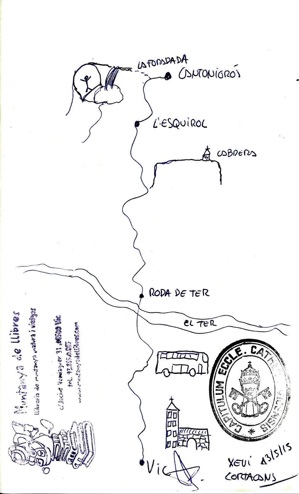
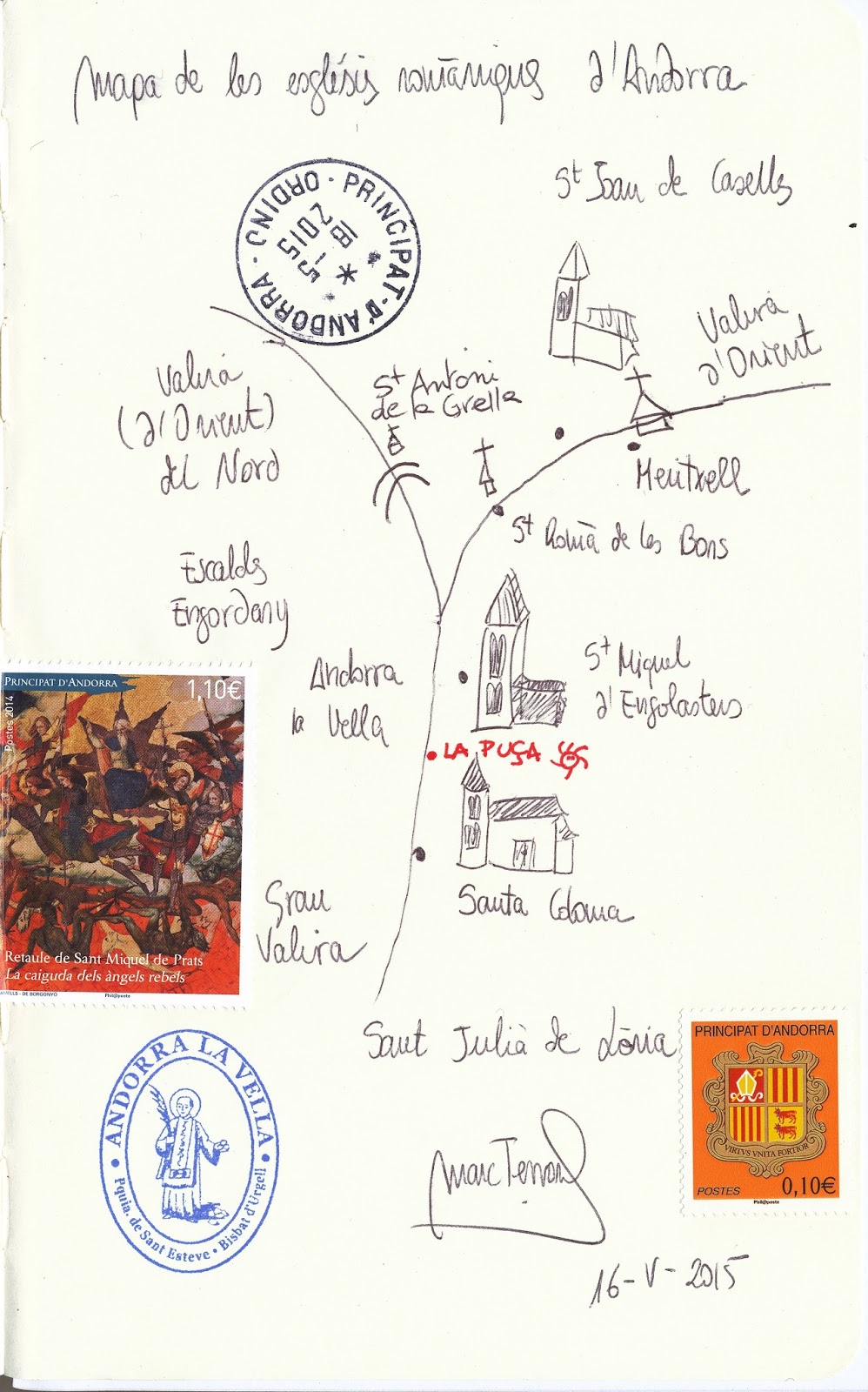
There would only be one basic set of rules for this linear cartographic experiment. The map should illustrate a given route to the place I was intending to walk to that day and was restricted to one facing page. Other than this the font of localised knowledge had the freedom to illustrate or draw in which way they pleased. I gave myself some strict rules also – to inform that I was on a pilgrimage and that the cartographer had to make do with their own devices. Many of the 65 maps achieved during the course of my 3 months journey were deliberately made not in my presence. Being the director would only contrive such so I gave trust that the person seeking a map from should do so in their own time taking custody of my Simpsons Moleskine, for even up to an evening undistractedly. As the number of maps in my sketchbook increased they actually improved with a couple of earlier renditions adding to the motivation.
Nonetheless there were wildly varying standards in map making and from people of all ages too. In a small bar in Fuente del Ebro an old man named Jesus shakily showed me the way to Venta Santa Lucia with his phone number included. That same day and at destinations end the 9 years old Miguel beautifully, but cautiously has illustrated that I indeed have a highway to follow to Bujaraloz. Manager and chef Miguel Espinosa of the Albergue de Peregrinos: San Francisco in Calahorra includes himself, the rare fresh vegetables I consumed and myself as a kangaroo en route to Alfaro famous for its storks (pictured). Some of the best illustrative maps were executed by the kind staff of the many tourist information offices passed on the way. The unexpected request from an Australian pilgrim took them away from their often banal requirements and demanded from tourist or pilgrims alike.
One of the best renditions along the way and for my sake early on into the project came from the 18 years old Basque – Uxue of Laguardia. Here she, and in good taste, illustrated her love of good wine production for I was about to step foot into the La Rioja region of Spain. My host for two nights in Zaragoza, Alejandro, shared my interest in bicycle touring, but clearly illustrated me complete with the Carrix cart I pulled from journey’s start to end. This walking aid became of increased assistance after my accident. However my journey slowed down and other means of transport were periodically required from then on. This said the near daily map making continued across France and into Italy, via Andorra where an aspiring opera singer illustrated for me that pocket sized country’s tiny Romanesque churches. At another point along the way and seeking water after a tiring day through heat and no accommodation found I was kindly given shelter first in a garage for the night. However Paul-Louis’s wife up graded my lodgings to a queen sized bed and dinner that evening with a fine breakfast laid out on the table the following day. His map includes the family cats Minette and Jacob – St James in disguise dare I say. Towards journeys end I was accompanied by a friend – Aurelie who I met at the ancient Ganagobie Monastery. Aurelie, who had only days before broken off with her partner of 6 years, even makes an apology on her map saying that she was so sad during my rest days spent with her in the French Alps.
Importantly I asked each person when possible to please sign and date their renditions. 65 maps later I would like to send my sincere thanks to all for their good work and kind assistance. These were not merely illustrative maps, but indeed had had their useful function into showing me the way during my peregrinations of 2015. Lastly my thanks should go out to Homer Simpson for his ability to break the ice in so many situations encountered.
Article published in the Confraternity of Saint James - Bulletin No 133 March 2016


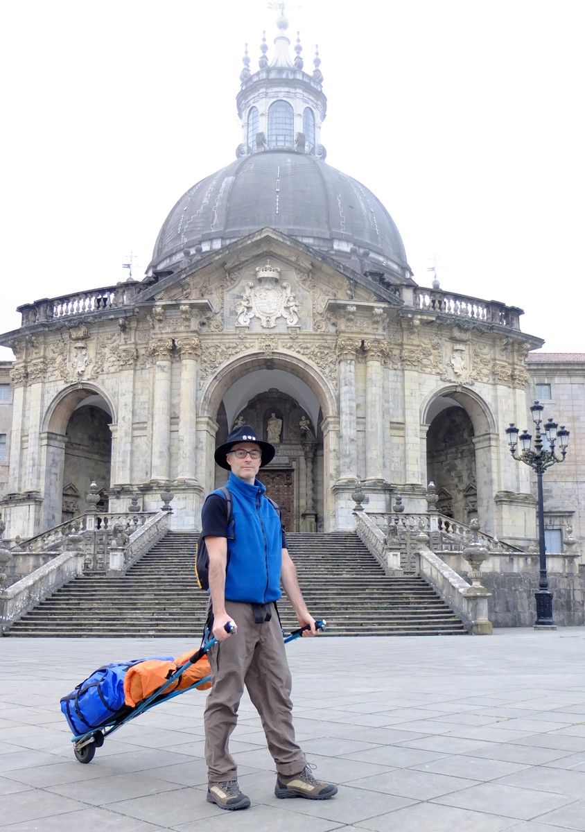
Have cart will travel - the Carrix cart I used for my 1115 km walk most of the way from Loyola (pictured) to Turin.
